Underfoot: WHAT IS THE SMALLEST FLOWER IN THE WORLD?

By, Susan Sprout

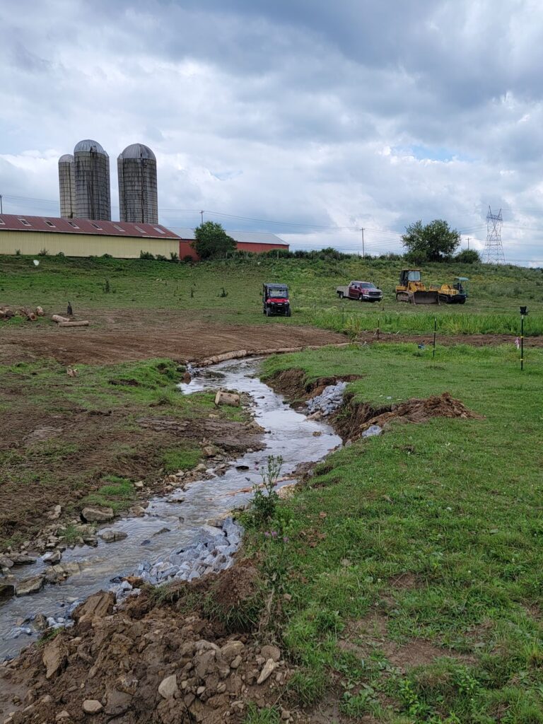
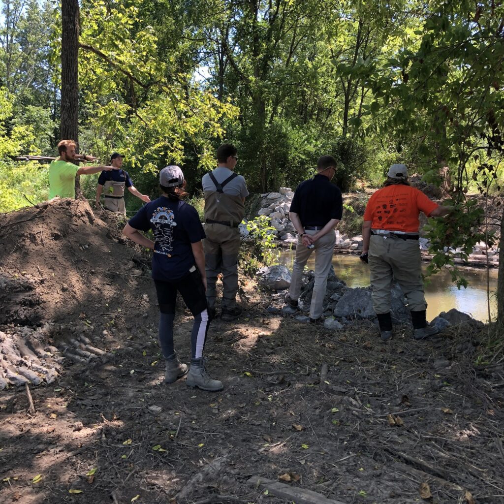
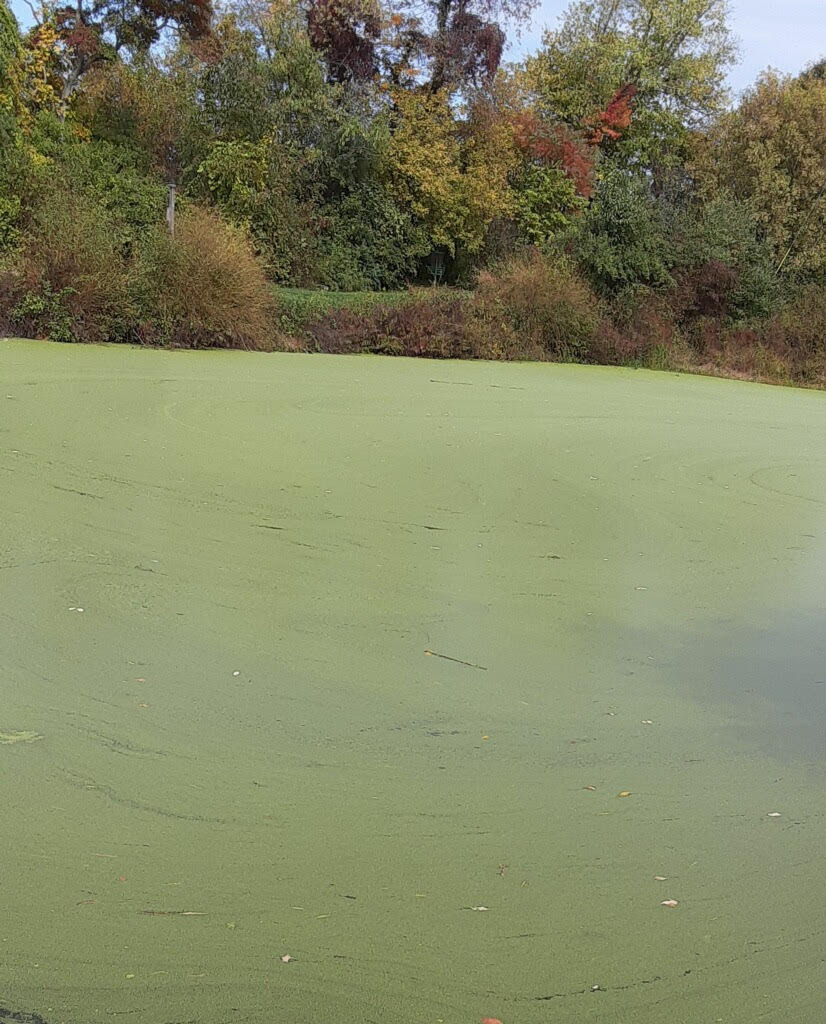
Did you ever go to the Library of Congress site named “Everyday Mysteries”? Luckily, I found it and the above question along with its surprising answer – Watermeal. Ever heard of that? I hadn’t, but I had seen the plant itself just four days earlier, growing in a pond as I walked the trail at Lime Bluff. What a coincidence! It is a joy to walk and bird and look at plants and trees there. That’s when I saw a completely green pond. Yuck, I thought, a total algae takeover! Then a slight wind arose, and all the green lazily swirled and parted to expose the water’s surface. NOT algae – because it would have stayed clumped together. I put my hand in the water and out it came, covered with lots of tiny green bumps. The plants were miniscule like poppy seeds and felt like them, too. 

The green pond.

I couldn’t wait to check out my PA plant reference. There I found Watermeal. Its other small relatives were listed and described, too, as species of Duckweed. But Watermeal is a different species and in a different genus and definitely the smallest of the whole bunch. Wow, the smallest flowering plant in the world growing nearby!

Using my binocular microscope and the grid pattern in the bottom of a Petri dish full of green specks, I was able to measure them – ranging from one-half to one millimeter long. Remember, there are 25.4 millimeters in an inch. Now, look at a ruler and be amazed at how tiny these plants really are! I am!

A closer look.

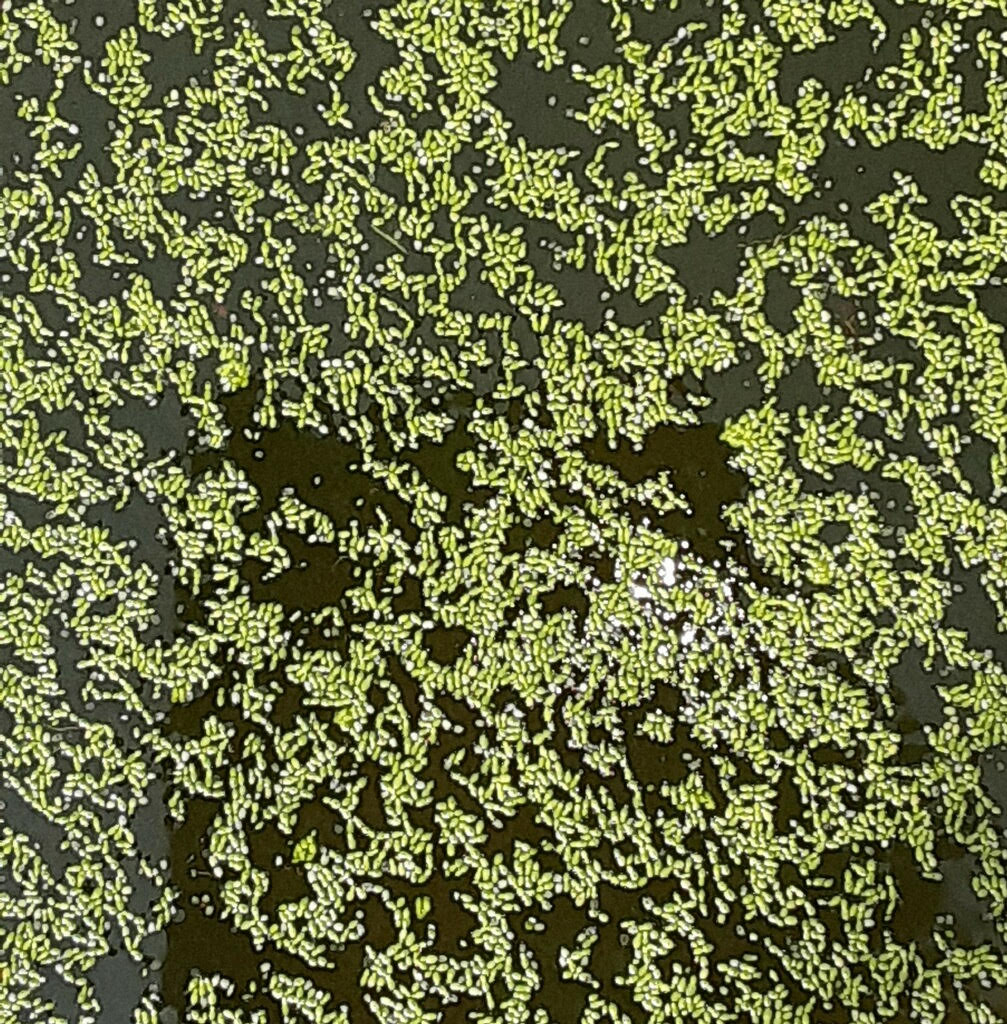
They have no roots, no veins, no stem. Just an oval-shaped leaf called a frond, kept afloat by tiny cavities filled with the oxygen made when they photosynthesize in the sunlight. They don’t bloom often, using their single anther (male part) and their solitary pistil (female part) to make one almost invisible seed. Most of the time Watermeal will reproduce vegetatively by making clones that emerge from budding pouches, located at one end of their fronds. The parent plant and clone may stay together for a while. In the fall, a special clone filled with starch called a “winter turion” is produced. The accumulated starch makes the turion heavier than water and it sinks, to overwinter on the pond bottom, using the starch to stay viable. It will rise in spring after making enough oxygen to create buoyancy. One resource indicated that Watermeal can cover an entire pond within a few weeks after arising from the pond bottom.

An even closer look at Watermeal.

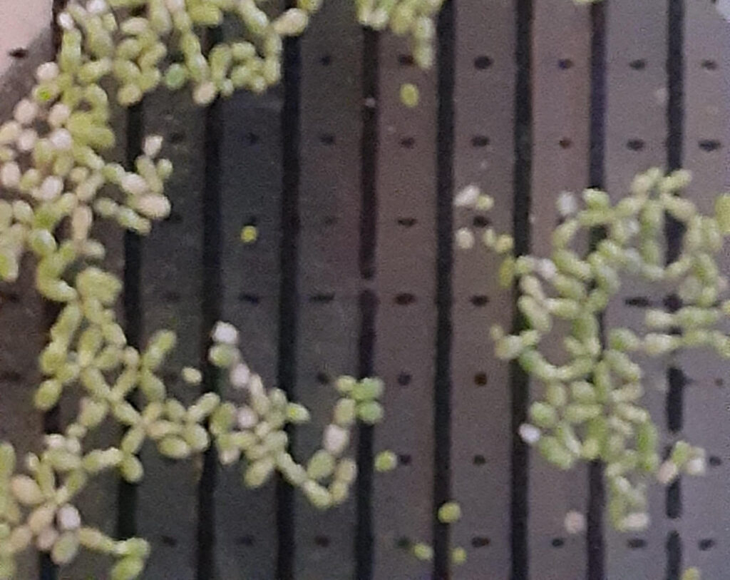
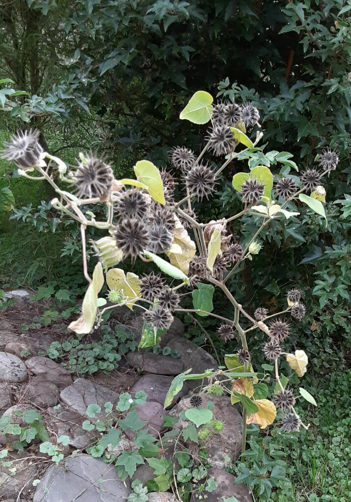
Watermeal’s scientific name is Wolffia brasiliensis. It is a member of the Arum Family, like Skunk Cabbage, Green Dragon, and Jack-in-the-Pulpit…a morphologically divergent member of the Arum Family. Recent DNA testing got the whole Duckweed Family classified as a sub-family within the Arum Family. Watermeal, native to both North and South America, is considered an annual plant. It grows in the fresh water of ponds, sinkholes, swamps and slow-moving streams. Many times, it is found floating among its larger Duckweed relatives.

A lot of research is being done with Duckweeds (Lemna) and Watermeal (Wolffia) because of their effective up-taking of carbon, nitrogen, phosphorus, pathogens, and toxins in the mitigation of polluted waters. With that kind of nutritious diet, some species can double every 36 hours. The downside is they need to be removed from the water before they die and release all of the contaminates back into the same water.

ROCK PICTURES from PICTURE ROCKS

By Susan Sprout

I wanted to write an article about the geology of our area – a study on the amazing hows and whys of the built-up layers and types of rock and mineral formations under us, plus the soils deposited here for growing things and us to walk on and build on. Researching and writing an article about that far down Underfoot would undoubtedly be a complex task, something I really don’t have the background for.

I’m here where I want to be looking for plants, and the plants certainly seem to know where they want to put down their roots in clay, dirt, sand, mud, rocks, acid, alkaline, wet dry. So I guess maybe there is no need…and yet, sometimes there are days… when I mosey along the creek, looking down, and want to know where the vast amounts of pebbles and rocks came from upstream.

I look at all of the different colors there, made possible by coal, slate, quartz, shale, limestone, mudstone – a palate of blues, greens, browns, pinks, ecrus, whites, blacks. All at one time were part of huge, gorgeous, solid mountains, the ancient Applalchians, first formed roughly 480 million years ago during the Ordovician Period and, some say, as tall as the Himalayas. Now in our time, eroded, broken down, tumbled and jostled until they are almost round, practically sorted by size as the bank slopes to the water – their placer and their maker. Millions and millions of years it took for the pretty rocks to get here, down to pick-up-able size, for kids of all ages to plop back into the water or skip across it, to enjoy the smooth feel of shale or the bumpiness of sandstone or just the fun of drawing colored pictures on flat rocks.

Underfoot: Pie Marker

By Susan Sprout

It is autumn – time to find your pie marker and get baking those yummy apple pies. What! No pie marker?

There is a type of plant that grows around here, commonly known as Pie Markers. The resemblance of their strangely-shaped seed capsules to the baking tools used for marking or fluting or crinkling the upper edges of pie crust is, well, remarkable! I was taught by my gram to use the pinch-finger technique for crimping my crust edges and have never owned a pie marker. Until now! Thanks to the owner of the antique store in Pennsdale, I  have an example to show you. 

Pie Marker flower with green seed capsules

The Pie Marker plant was brought to this continent in the 18th century to be cultivated for its strong, jute-like fibers for making string, ropes, rugs. Indigenous to India and grown in China from around 2000 BCE, known as Qing Ma, it was used medicinally for an antiseptic, an astringent, and as a demulcent – think “soothing”. The fiber business went bust, and we now have a plant whose seed output yearly (per plant) can top 15,000, depending on height – which can be up to five feet tall, having many downy branches, eight-inch velvety leaves, and lots and lots of five-petaled yellow flowers. The pollinated flowers create the seed capsules made up of twelve to fifteen segments that form the round “pie markers”. 

Older plant with mature seed capsules

Pie Marker AKA Pie Maker AKA  Abutilon theophrasti  AKA Velvet Leaf AKA Indian Hemp AKA…I found eleven common names so I’ll quit now… is considered a damaging weed to agricultural crops like corn and soybeans because of its competitiveness over nutrients and water plus the fact it harbors maize and tobacco pests and soybean diseases. There are many other plants in the Mallow Family – okra, cotton, ornamentals like Rose of Sharon, Hollyhocks and Hibiscus – that are “positive” members of our plant community.

Botanical and man-made pie markers

I may have inadvertently spread Pie Marker seeds on my property after collecting the pods for a dried flower arrangement. I found them growing on the edge of a field. They seem to like disturbed places like edges, compost heaps, and alongside buildings in town. They added a lot to the arrangement. But, I will have to be vigilant weeding new plants as they appear next spring. Their seeds can remain viable for 50 years in dry soil. I guess that will keep me busy for the rest of my life!

Little Pine Creek Improved

When a drought is finally declared the day before construction starts on a stream project, to be followed with over 3” of rain beginning only a few hours later, it makes for an interesting project.

Mark Sausser of Pennsylvania Fish and Boat Commission explains the construction process to Little Pine State Park officials as the excavator holds the sill log in place while the crew uses rebar to pin the log to the streambed.

The Little Pine Creek streambank stabilization and habitat restoration project kicked off with a 2-day rain delay, and more rain throughout the week and a half long project. The deviation from typical stream flow, accompanied by a shortage of delivered logs for structures, enabled the stream team to show their flexibility and creativity, as they had to modify the original plan. With DCNR’s permission, the crew cut a few trees (mostly willow and sycamore) to use as face logs for the mudsills, with intentions of the trees reestablishing roots to help further stabilize the bank 

The Northcentral Pennsylvania Conservancy partnered with Little Pine State Park (DCNR Bureau of State Parks) and the Pennsylvania Fish and Boat Commission on a project to address eroding streambanks along Little Pine Creek within Little Pine State Park. Using log and rock structures approximately 1,000 feet of the streambank were stabilized and some floodplain access restored.  

A bird’s eye view of pinning a sill log; drill the hole, find the hole, use sledgehammer to get rebar started, finish pounding rebar with jack hammer and bend the extruding end downstream.

Specifically we looked at the stream stretch starting at the shooting range going downstream. Little Pine Creek is a Cold Water Fishery that is attaining for aquatic resources. The project site is in a stretch of the stream that also has naturally reproducing trout and is a Keystone Select trout stream. 

Little Pine Creek’s streambanks are eroding, creating bank heights of 8 to 10 feet from water’s edge to the top of bank. The sediment from the eroding stream banks is entering the stream system and depositing in the area of this proposed project and down stream. 

Grading what used to be the 14’ vertical bank, once grading was completed the bank was seeded and mulched. Also notice the willow tree used for structure work in the bottom left corner, the goal is for the tree to establish roots and grow to further stabilize the bank.

To give you some idea of the amount of sediment coming into the system we can use the location of the swimming buoys at Little Pine State Park’s lake which is downstream. The buoys are placed where there is 4.5 feet of water depth. In 2020 the buoys were placed approximately 75-feet from shore, in 2021 they were placed approximately 125 feet from shore. The buoys had to move further out because of the sediment filling in the lake.  

As you will see in the aerial photos comparing the site from 1995 (on left) to 2015 (on right) sediment is filling in the lake at Little Pine State Park. The sediment is from the eroding stream banks. 

By working to eliminate sources of sediment and restore access to the floodplains the hope is Little Pine Creek can remain a Cold Water Fishery and continue to be attaining for aquatic resources as well as meet these other designations. 

Jason Detar is a fisheries biologist for the Pennsylvania Fish and Boat Commission and serves on the Eastern Brook Trout Joint Venture. He conducted a habitat analysis of Little Pine Creek. When asked by email his thoughts on this project he responded with: 

“Substantial streambank erosion is occurring throughout the proposed project reach on Little Pine Creek. This has resulted in significant sediment transport downstream in the greater Pine Creek/West Branch Susquehanna/Susquehanna River watersheds impacting water quality and habitat. The Little Pine Creek stream channel is becoming overly wide and shallow from the bank erosion.  Little Pine Creek is unique in that it is a large stream that supports a wild Brook Trout population throughout the project reach. Brook Trout are intolerant of sediment and elevated water temperature. Completion of the project will improve water quality by reducing erosion and sediment deposition and improve habitat for wild Brook Trout.” 

The crew built modified sawtooth mudsills, root wad deflectors and placed boulders. The mudsills and root wads slow the flow of the stream and redirect it towards the middle of the channel, which relieves pressure from the heavily eroded bank. These structures also provide habitat for fish, turtles, and other animals.  The rock piles in the middle of the stream were intended to be large, individual boulders which would create scour pools on the downstream side. The 14’ high vertical bank was graded to reconnect Little Pine to the floodplain, this will allow for sediment to settle out into the meadow above rather than continuing downstream and filling the dam during high water events. 

Several sections of the modified sawtooth mudsill are seen here; the crew pins a face log on the downstream section, the completed upstream sections are being back-filled with stone, once all of that is complete, the bank will be graded.

We anticipate continuing this partnership with DCNR at Little Pine State Park to implement more stream restoration along this popular stretch of naturally reproducing trout stream. 

A shout out and thank you to Pennsylvania Fish and Boat Commission, Little Pine State Park, the Pennsylvania Council of Trout Unlimited, and the Coldwater Heritage Partnership for their help with the project! 

Underfoot: SHINGLE OAK

By, Susan Sprout

Question: When does an oak leaf not look like an oak leaf?

Answer: When it is a Shingle Oak Leaf!

We’ve been taught there are two groups of oaks: white oaks whose leaves have rounded lobes on them and red oaks with sharp pointed and toothed leaves. Shingle Oak, or Quercus imbricaria, is a type of native red oak that has no points or teeth on its leaves – just nice smooth edges. Occasionally they may be found growing on moist hillsides or in bottom lands. I spied one walking on Canfield Island last week. I did not know what it was. The tree caught my eye because of its shiny, dark green leaves that looked sort of like rhododendron leaves only smaller and not leathery. I found a small bunch of leaves that had fallen, or been chewed off the tree, lying beneath it. They were smooth-edged, ranging in size from four to six inches long and were lightly furred underneath by very short, tannish hairs. I had to use my magnifier to determine that. Of course, it was all of the acorns growing on and lying beneath it that really clued me in…IT’S A SPECIES OF OAK! 

This Shingle Oak could grow to 100 feet in height.

Shingle Oaks are more frequently found west of here in the Ohio and Mississippi River Valley regions. They are commonly used as ornamentals, and this one may well have been planted here. What a treat to find and identify it! 

Twig of Shingle Oak leaves

Shingle Oaks flower in May when their leaves are about half-grown. Their acorns will then be ripe about eighteen months later. The species name imbricaria is Latin for “like a shingle” which could indicate its use as a source of hand-split shingles or shakes. Or, maybe, because of the caps on the small brown acorns that have wedge-shaped, pointed scales overlapping to resemble a shingled roof.

Acorns are about 1/2 inch in length 

How many native animals and insects need native oak trees for food or habitat? Of 435 species of oaks worldwide, 91 are found in the United States AND support more caterpillar species than any other genus of plants in all of North America – not to mention all the animals that eat acorns. Read more about them in Doug Tallamy’s book, “The Nature of Oaks: The Rich Ecology of Our Most Essential Native Trees.”

Underfoot: SULPHUR POLYPORE

By, Susan Sprout

Well, I’ve done it again – sneaked out of the Plant Kingdom and into the Kingdom of the Fungi!

Sulphur polypores on a dead tree

And for a very good reason, too, just look at this fantastic group of Laetiporus sulphureus. Just call it Chicken of the Woods, Sulphur Shelf or Sulphur Polypore. It was a very colorful find on an extremely brownish and crunchy- dry hike to the top of Skyline Drive. And who wouldn’t want to hang out on the side of a dead tree overlooking this view, hmm? All of those overlapping, bright orange, fan-shaped caps range from smooth and suede-like to finely wrinkled with sulphur yellow margins and pores, not gills, underneath. Those pores, tiny little holes, dispense white spores, creating another generation of wood recyclers. The living, dead or decaying wood they grow on provides them with the nutrients to live and reproduce. The bright coloration will fade as these organisms age. The fresh flesh, thick and soft, will become tougher, not decaying like the mushrooms in your yard would.

The view!

Sulphur Polypores grow fruit bodies from spring to autumn. They range across the North American continent, east of the Rockies , providing good eats for beetles and deer. 

The many pores of a polypore

Underfoot: NORTHERN WILD SENNA

By, Susan Sprout

Northern Wild Senna is a member of the Fabaceae family, well-known as the legume or pea or bean family and having about 20,000 species in many countries. This particular species, Senna hebecarpa, is a perennial plant native to northeastern United States from the Great Lakes to Georgia. I found it growing in a field of goldenrods. Taller than I am, it was a real stand out in all that yellowness because of its height. It has yellow flowers, too. Its leaves are pinnately compound – smooth-edged leaflets arranged in pairs, up to ten opposite each other on a single stem, kind of like the barbs of a bird’s feather are arranged on a quill.

Northern Wild Senna plants in the field

This plant’s blooming period begins in late summer, and its yellow petals are beginning to turn white now as they age. Very visible in each flower are five black anthers containing pollen and one curled pistil with long, white hairy edges waiting to pull in the pollen grains. The pistil will slowly develop into a flat, brownish seed pod having up to eighteen segments, each containing one seed. A mature pod is curled and amazingly hairy.

Closer look at some developing seed pods

Something else that sets this plant apart from many is that its flowers do not contain nectaries, the glands that produce nectar! The bees that visit, come for its nutritious pollen because it is higher in protein according to a study done at Penn State in 2016. So where’s the nectar? It is in small, club-shaped glands found singly on leaf stems near their point of attachment to the main plant stem. The nectar there seems to attract parasitic wasps, lady beetles and ants which may in turn protect the plant from other types of insects determined to eat its foliage.

Yellow petals turning white, black anthers, above the red dot is a nectary

Northern Wild Senna plants have a tendency to spread by horizontal rhizomes under the soil and create colonies. They like partial to full sun and loamy, moist soil near streams and water catchment areas. They can also live in sandy and rocky places, too, once they get a foothold. The plants have a vertical growing habit, but may get top heavy as the seed pods develop and flop over sideways.

White-tail deer and other herbivores don’t seem to care for the rather toxic and cathartic (purgative) foliage. Senna plants, like this one, and their near relatives, have been used by native populations in many countries for millennia as laxatives, worm remedies, and as poultices for healing sores.

A Flat Tire for One Leads to Help for Many

NPC’s members have always understood that when we work to conserve a property through a partnered acquisition we should be ready to help ensure people recreating and using the property can do so safely. This means helping with infrastructure needs in areas where we’ve added land to the state system.

This time, staff realized what was needed through their own bad luck. A flat tire while bike riding on the Pine Creek Rail Trail has led to a new bike repair station and tire pump on the Trail. Out of air and 8 miles from the car, there was plenty of time to think about what would be helpful and partners that could help.

NPC worked with the Pine Creek Preservation Association and the Tiadaghton State Forest staff to get the unit and get it installed. (Thank you maintenance crew!!!!)

The idea is to help bicyclists who may be having bike problems and are trying to get back to their car (see first paragraph above). This unit is installed at the comfort station at Bonnell Flats so the Bureau of Forestry staff can keep an eye on things.

Jersey Shore Borough has installed a similar unit in the Borough at the trailhead. There are also three units in the Tioga County stretch thanks to the Wellsboro Rotary.

While we hope you never need it, we’re glad we could partner with other groups, so they’re there!

Teamwork on Halfmoon Creek

The second week of August the stream partnership worked on a project on Halfmoon Creek in Centre County.

The Centre County Conservation District is working with the landowner on some management changes.

Once completed this project will have new cattle exclusion fencing and a stream crossing to protect the newly stabilized streambank from erosion. 

The District is using funding partially from Pennsylvania’s Department of Environmental Protection (DEP). When DEP’s watershed manager was reviewing the project on site with the District, he asked if the landowner had been approached about log and rock structures to stabilize the eroding streambanks.

The project has a lot of partners and a lot of moving parts. In early July we all met on site to review everyone’s timeline and discuss how to coordinate and what needed to shift around.

One thing led to another and the stream partnership worked on the streambanks while the fencing crew worked on the new pasture fencing and getting the livestock out of the stream.

Pennsylvania Fish and Boat Commission oversaw construction and were in the stream building the structures. Sara helped out for one of the days they were working.

In these photos you can see the difference before and after log vanes and log framed deflectors were installed. In this before photo, notice the height of the streambank. You can also see the cutbank, or the dirt, with the grass on top.
In this after photo the left side of the photos is graded and ready for seeing and mulching. The right side still needs some backfill and graded. Now during higher flows, the water will be able to rise up and flow out of the stream channel instead of washing away soil and eroding into a deeper canyon.

Chesapeake Conservancy is also involved in getting various Best Management Practices installed that will reduce the amount of sediment and nutrients entering the stream.

ClearWater Conservancy is using grant funding they have to plant a riparian buffer in the areas the livestock will no longer have access to the stream. By installing the log and rock structures first we’ve stabilized the streambanks with trees adding to that stabilization as their roots grown and help hold the soil.

David relocated a northern green frog upstream before structures were constructed where it was found.  

Better Access Less Sediment on State Game Lands 252

The War Department condemned the town of Alvira in Union County, PA in 1942 in order to establish a munitions manufacturing facility. Known locally as “the Ordnance,” the site used water drawn out of the West Branch Susquehanna River below Montgomery to manufacture munitions for the war effort during World War II.

This sign on State Game Lands 252 provides a snapshot of the property’s history.

Eighty years later, the Northcentral Pennsylvania Conservancy worked with the Pennsylvania Game Commission, Pennsylvania Fish and Boat Commission, Pennsylvania Department of Environmental Protection, and Union County Conservation District to stop the erosion created by establishing the Ordnance.

Pennsylvania Fish and Boat Commission staff and Union County Conservation District staff work together to secure a log with rebar.

After the residents of Alvira were gone, the structures in the community were torn down and burned with the exception of a stone church. The Pennsylvania Ordnance Works was established and production got underway.

During the process of establishing the Pennsylvania Ordnance Works, a perimeter road was built. Presumably for security and to allow the property boundaries to be patrolled and secured.

That road was built in a straight line. Spring Creek which flows through the southern side of the Ordnance does not flow in a straight line. It bends and turns and twists back.

The straight road cut off an oxbow, or u-shaped bend, in Spring Creek from the flowing stream channel. By looking at aerial photos from the 1930s and today you can see the large wetland that developed where the oxbow was.

During a spring site visit the Canada Geese were using the wetland formed by cutting off the stream’s oxbow.

Streams are stubborn. If they want to bend and wiggle, they will flow and cut and erode their way into the bend and wiggle they want.

That’s what happened here. Over time, the now channelized Spring Creek was eroding the streambanks as it was trying to get some of its bend back.

In the late 2010s the Pennsylvania Fish and Boat Commission (PFBC), Pennsylvania Department of Environmental Protection (DEP), and Union County Conservation District (UCCD) looked at the site and developed a design to help stabilize the streambanks and improve access to the stream.

This stretch of Spring Creek is on State Game Lands 252. After World War II the property taken for the Ordnance was divided up. Just over 3,000 acres was used to established State Game Lands 252 in 1964.

Since State Game Lands are open for public recreation and this stretch of Spring Creek is stocked there is a lot of fishing activity on the property. The activity was pretty concentrated in a couple of spots because it was difficult to get to the stream. The perimeter road, now used as a management road by the Game Commission, creates a steep side that isn’t easy to get up and down.

Sadie is standing at the top of the bank. You can see how steep the streambank is and how difficult it would be for someone to get down to the stream to fish.

With a design in hand the group waited until funding could be found to support the project.  That funding was found in late 2021. The plan was dusted off and updated. Streams can change a lot year to year and this stream had over 5 years to change.

Austen is in the stream using his feet and the staff (in his hand) to determine what material is on the stream bottom. Jason is on top of the bank providing perspective on the height of the eroded streambanks.

The site was added to the schedule for the 2022 construction season and additional grant funding was secured through Keep Pennsylvania Beautiful’s Healing the Planet Grant Program with support from The GIANT Company.

The first two weeks of August were set aside for the project. The team wanted the water levels down and August is typically dryer with lower water levels. There are some deep holes in the stream and we didn’t want those to be problematic for construction. Another reason to wait until August – there’s less activity on this area of the State Game Lands. The crew saw a trail runner a few times and a couple of horseback riders, but we weren’t interfering with their recreation.

Before we got on site, the Game Commission’s crew brushed out the area to make it easier to work and to help set the stage for a tree planting. They set some of the trees so they could be used in the structures and built brush piles with some (we not only create fish habitat, but we also caused rabbit habit to be created).

The team started upstream and worked downstream installing the log and rock structures.

It really didn’t take long for fish to move in. The first couple of days the team wasn’t seeing much, by the end of the project the group was seeing more fish overall and a greater variety of fish species.

The contractor did a great job with the bank full benches. These areas allow the stream to spread out in high water, slowing down the water’s speed and reducing the erosion. They also create areas where people can stand and fish. The group worked to ensure the bank leading to the bank full bench was sloped in a way to make it easier to walk down and get to the stream’s edge.

Along water’s edge you can see woody material sticking out from a habitat structure. The bank was graded with more slope to allow water space to spread out and slow down. There was enough rain to get the winter oats to sprout!!

Things will be given a year or two to settle in and then more trees and shrubs will be planted. These plants will help shade the stream to keep summer temperatures cooler, and the roots of the plants will provide additional stabilization.

Pennsylvania Fish and Boat Commission Executive Director Tim Schaeffer stopped by on the last day of construction. It was a great opportunity to highlight the teamwork needed to get projects on the ground.

During the tour, Tim got to see completed structures and structures that still needed back filled and graded. Here the group is at one of the structures that still needs back filled.

If you use State Game Lands 252 stop by and let us know what you think of the project.

If you’re interested in learning more about Alvira Robin Van Aucken and the Montgomery Historical Society have sites that may be helpful.