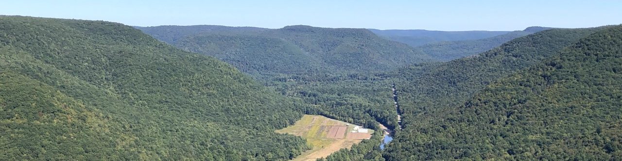
Winter can be a great time to visit potential stream projects. With no leaves on the trees and other vegetation dead or dormant it’s easier to see the streambanks and what’s going on. Snow on the ground or ice on the stream stop the visits.
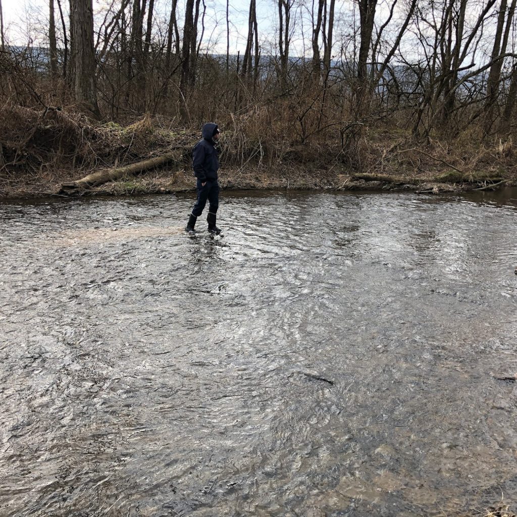
So far, the stream team has been able to get out to quite a few sites. At this site in Union County (above), Austen was able to “check out” the substrate on the stream bottom. By walking around he can use his feet to feel what’s underneath the water. Does he kick up a lot of sediment? Is it stone or muck? How big do the stones feel? How much wiggle room do the stones have?
You can see at this Union County site he had a small trail of sediment behind him as he walked up stream.
At the site shown above in Northumberland County, the snow-ice on the ground didn’t hinder design, but the skim of ice at the edges didn’t allow all the final design to happen.
While we crossed the stream in the shallower spots, the water was cold enough and deep enough Austen didn’t check out the subtrate here. The team developed a general concept and will be back in March to do a “final” design for permitting and ordering supplies.
The 2021 “stream season” started
in January with a stream crossing (and ice on the water) and wrapped up this
week with our annual project review meeting (the only ice was in an ice chest
with soda and water). The stream partnership, made of up of NPC, DEP, PA Fish
and Boat, and the County Conservation Districts in the region, meets twice a
year as a group. We meet in the spring to review what is planned for the year
and in the fall to review what actually happened.
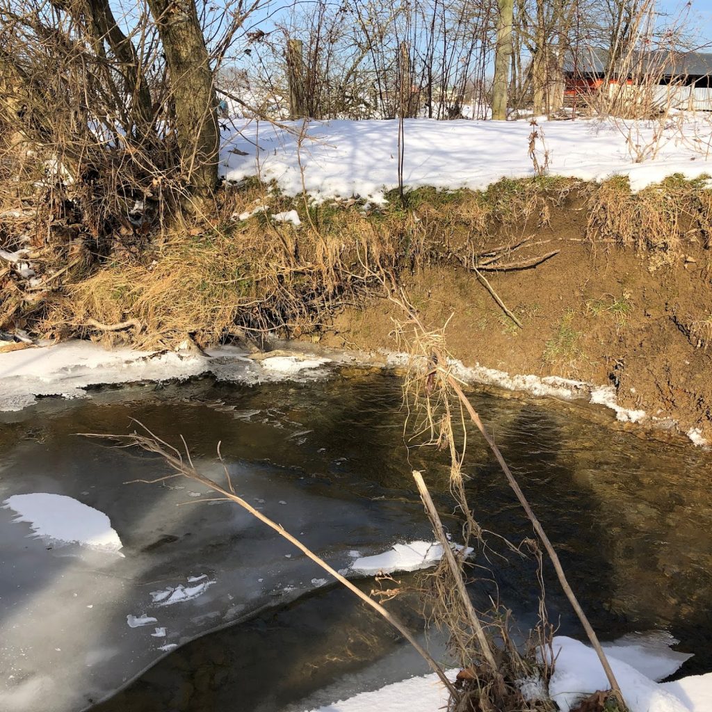
Do you see the ice shelf on the right side of the photo? The ice shelf is at the edge of the stream by the brown grass. The existing crossing was backing up water. The ice formed on top of that water. The ice stayed as the water flowed away.
The fall meeting allows each
County Conservation District to review a project in their County. While DEP and
the PA Fish and Boat Commission are at all the projects, the District staff
often only get to see projects in their county. Sharing photos as well as any “lessons
learned” or “if I could do it again, I’d do this differently” helps everyone
learn more and often generates new ideas.
The partnership is always evolving
as staff changes occur in the partner organizations. We took an opportunity
this year to ask one of the new staff to explain a technique we use when we
can. As the equipment operator breaks the ground, it’s broken up in chunks. The
sod is saved and set to the side. The sod is then replaced. The sod will recover
more quickly than grass seed will germinate and fill in.
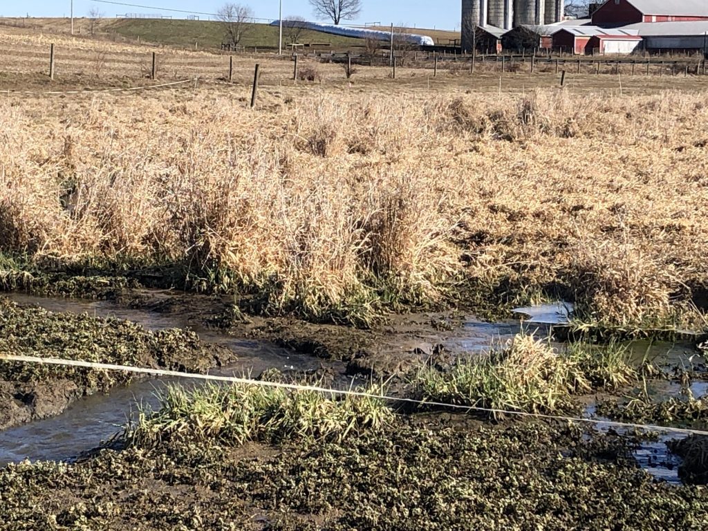
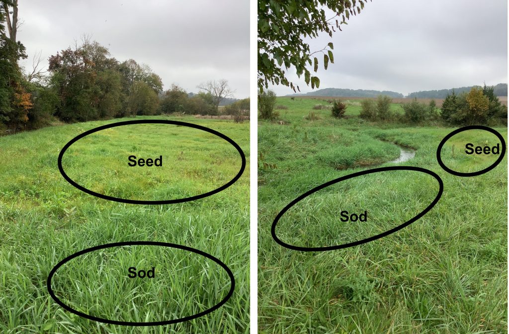
A project along Limestone Run in
Northumberland County had the sod technique used. Several large rain storms
came through this year. The site made it through the storms, but provide a couple
of photos that are a great contrast so you can see the sod versus seeding.
In the photo ont he right, you can see the grass seed is trying to establish and off to a good start, but it’s not “thick” as the existing sod. The roots below the surface only get as deep or long as the vegetation on the top. The shorter the grass, the shorter the roots. Short roots don’t hold as much soil and long roots.
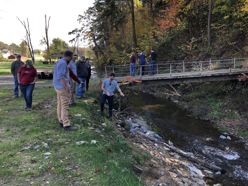
After looking at photos and maps
of projects from the 2021 season, the group toured a project. The landowners
has been managing the property for a number of years. They allow neighbors and
friends to use the property for picnics and birthday parties. The day we
stopped a high school hockey team was going to be visiting for a season wrap-up
party (including pumpkin decorating).
The landowners recognized the
eroding streambanks were a problem and tried fixing it themselves. They
realized it was helping, but wasn’t doing enough. The stream partnership worked
with the landowner (who is an equipment operator and did the work) to install a
series of log structures. Over the series of rain events, some of the topsoil
from the final grading washed away, the structures held and are doing great.
The stream partners are already
talking about and planning for 2022. Now, if it’s a mild winter and there isn’t
a lot of snow, there might be more crossing work and fencing done. You never
know.
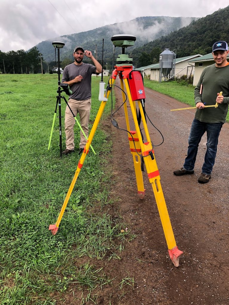
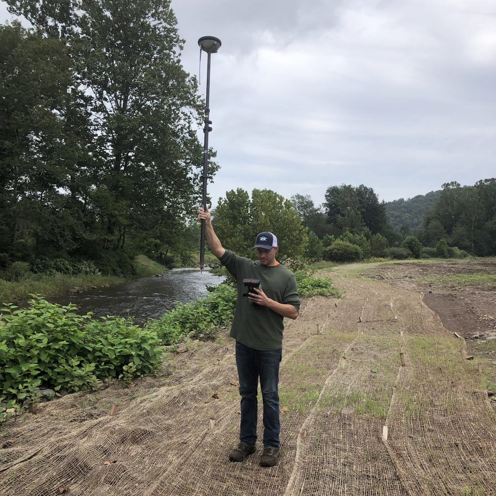
Some survey work was done last week at State Game Lands 134 (along Plunketts Creek in Lycoming County) to get information on the elevation at the site with the berm removed. As you may recall NPC partnered with the PA Game Commission, the 333rd US Army Reserve Engineering Unit, and numerous other groups to reconnect Plunketts Creek to its floodplain by removing an earthern berm along the Creek.
Mark and Trent with BluAcres found the control point from the survey work during the design phase and set up the equipment.
The yellow spot on the ground is a piece of rebar with a cap on it. This was set as a control point the first time they went out and will be used at every subsequent visit.
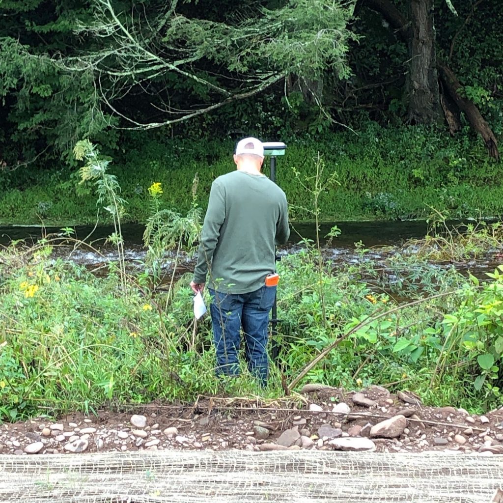
Trent found the previous survey points and collected data at those points.
Trent has a map of the previous points in his left hand and the survey unit in his right hand. Surveying is a lot different than it used to be.
Trent even humored me and held up the staff so the tip was “sitting” on what would have been the top of the berm.
The bottom of the staff is “sitting” on top of the berm. So basically, Trent would be up to his neck in dirt if the berm were still there. (Trent was so accomodating in part because he is a graduation of Lycoming College and worked summers for the Clean Water Institute at the College. Dr. Zimmerman generall has the CWI-ers spend at least a day on a project of the northcentral stream partnership.)
They’ll download the data. There will be some computer magic and then there will be a pretty new map. This work is to help the agencies who issued permits that the work resulted in the correct grade – the stream is reconnected to its floodplain.