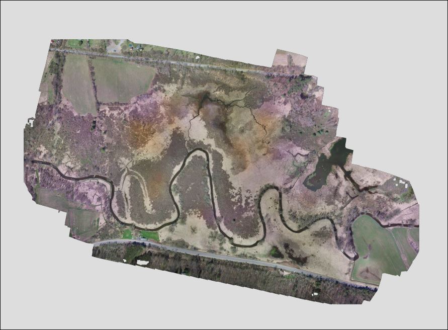
 Remote Intelligence recently flew a drone over the Cavanaugh Access to give a better idea of the extent of the wetlands. The photo is created from a series of photos stitched together electronically. It will be helpful to land managers to have this photo to compare to past aerial/satellite images and to look at going forward.